Storms collide, causing deadly severe weather on Monday, governor says
BATON ROUGE, La. (WAFB) - Louisiana Governor Jeff Landry held a news conference around noon on Tuesday, May 14 to discuss deadly storms that hit parts of Louisiana on Monday night.
“Unfortunately, today marks the eleventh severe weather event that GOHSEP has had to respond to for the citizens of this state,” Landry said.
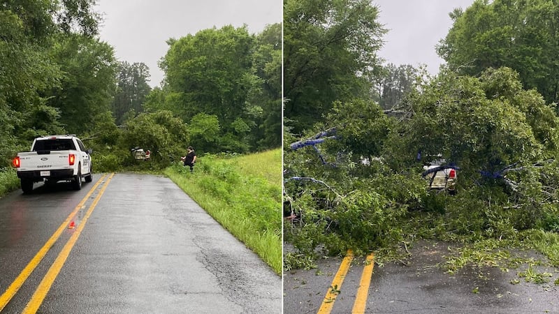
The governor thanked first responders, police officers, deputies, and firefighters for clearing debris from roads in some of the harder hit areas across the state.
Landry went on to thank paramedics for treating those injured during storms. He also thanked linemen for working around the clock to restore power.
“I think it’s important for everyone in the state to understand exactly what happened yesterday,” Landry explained.
The governor confirmed a storm system crossed into Louisiana at the Texas border along I-10 yesterday afternoon, impacting Calcasieu, Beauregard, Allen and Jefferson Davis parishes.
As it moved from west to east, another storm system moved from the Gulf of Mexico, headed north through Vermillion Bay causing both systems to converge near St. Martin Parish.
“The convergence of those two systems caused the storms to grow in both intensity and size,” Landry said.
This led to the storm impacting St. Martin Parish, Iberville Parish, Pointe Coupee Parish, West Baton Rouge, East Baton Rouge, East Feliciana and Livingston Parishes.
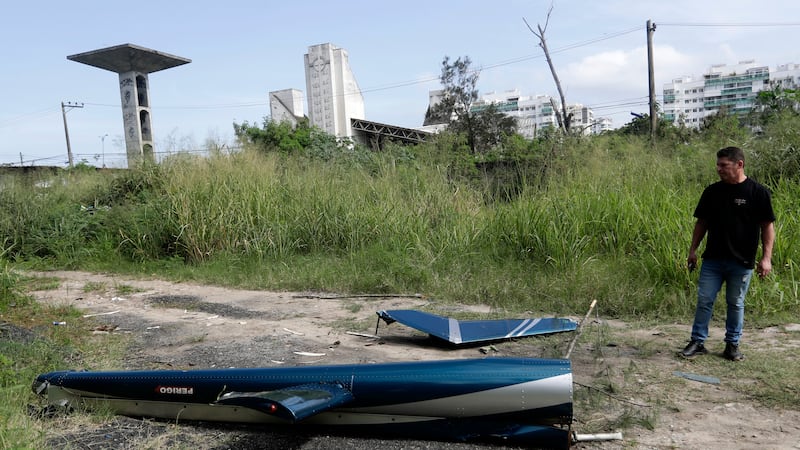
The storms collided, creating a dangerous and deadly situation.
The Louisiana Department of Health confirmed there were three storm-related deaths; 2 in West Baton Rouge Parish and another in St. Martin Parish.
Jacques Thibodeaux, the Director of the Governor’s Office of Homeland Security and Emergency Preparedness (GOHSEP), discussed the timeline of the system as it moved through the state.
- 4:23 p.m. - First tornado warning in Calcasieu Parish
- 4:49 p.m. - Additional warnings in Jefferson Parish, Calcasieu Parish, Cameron Parish
- 5:30 p.m. - Jefferson Davis, Acadia Parishes begin to have tornado warnings
- 6:06 p.m. - Other system rolls into Vermillion Bay. Lafayette, Acadia, St. Martin begin to have tornado warnings
- 6:08 p.m. - Convergence of two storm systems occurs
- 6:30 p.m. - Storm moves east into Pointe Coupee, West Baton Rouge, Iberville
- 6:36 p.m. - More tornado warnings in St. Martin, Iberville, West Baton Rouge, Pointe Coupee
- 7:11 p.m. - Ascension Parish, Livingston, Iberville, East Baton Rouge
- 9 p.m. - Final warning in St. John Parish, Tangipahoa Parish
- 11:47 p.m. - All clear given
“It was a very, very quick moving system,” Thibodeaux said.
In total, 16 parishes were impacted by the weather system. The maximum amount of power outages peaked at 160,000.
The National Weather Service of Lake Charles has confirmed 2 tornadoes passed through the area. Officials said an EF-1 touched down in Westlake and tracked into downtown Lake Charles with max winds of 100 mph. Another confirmed tornado touched down in Sulphur, but the intensity hasn’t been determined yet.
Click here to report a typo.
Copyright 2024 WAFB. All rights reserved.